ON THIS PAGE:
P2 Field Operator is a map-based entry and collaboration tool. Users are able to capture field data, and live sync with the back office using mobile capabilities.
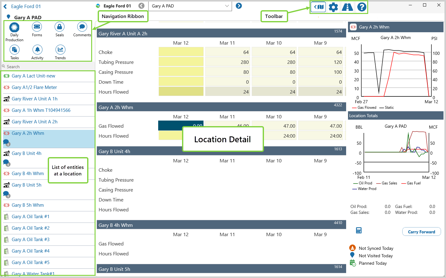
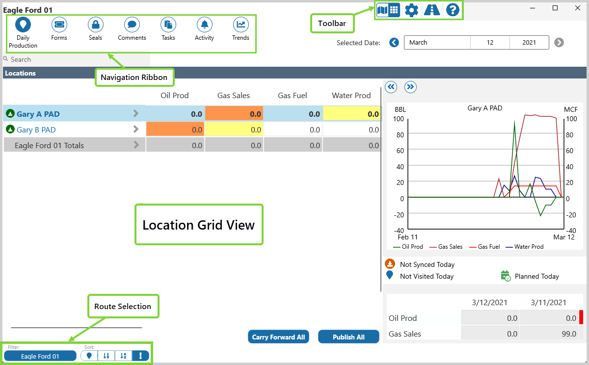
Field Operator opens in Map View, one of the three main views of the application. Grid View, and Location Detail, are the other main views.
In each of the main views you will find the Navigation Ribbon and the Toolbar.
Map View
In the Map View, the Navigation Ribbon, Toolbar, and Information Panel frame the interactive map.
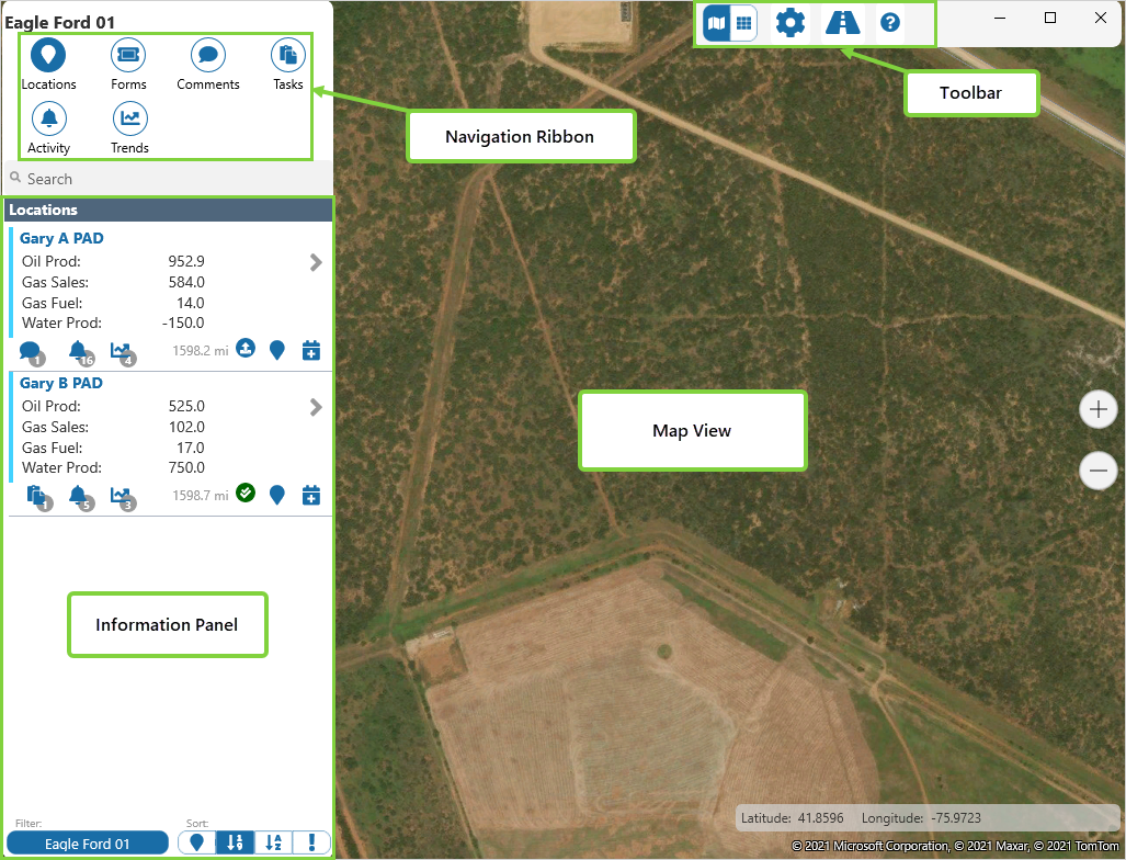
| Navigation Ribbon |
The main method of navigating in Field Operator. This is where you'll select from Locations, Forms, and Comments, to display summary data in the Information Panel. From there you can elect to display the Location Detail view, or the Location Overview box. Route Surveillance users also have the option of selecting Tasks, Activity, and Trends. |
| Toolbar | Access View Mode, Settings, Journey Planner and Help functions from the Toolbar. |
| Information Panel | Summary information is available for all the Navigation Ribbon items. |
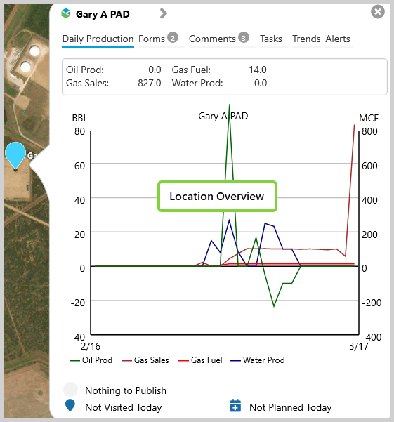
Location Overview
Location Overview is a part of Map View, and is a snapshot of what is happening at the selected location.
Open the Location Overview box by clicking in a Location Summary in the Information Panel, or on a marker on the map.
In it you will find a summary of Daily Production figures, and the latest Forms, Comments, Tasks, Trends, and Alerts.
Grid View
In the Grid View, a list of locations and summary information is displayed in a table format.
Navigate to this view by clicking the View Mode ![]() icon in the toolbar.
icon in the toolbar.
Location Detail
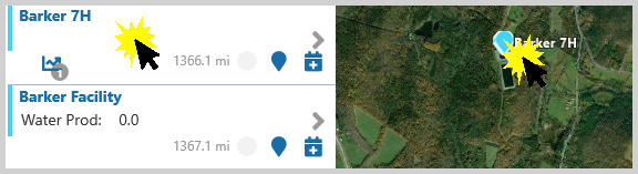
Navigate to the Location Detail view by clicking the on the Detail ![]() icon from Map View, Grid View or Location Overview.
icon from Map View, Grid View or Location Overview.
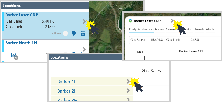
This view displays the details for a single location in an editable format.